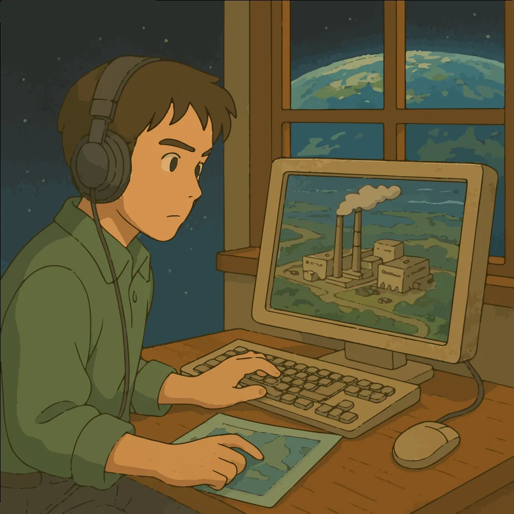
Earth observation from space has become a powerful tool for monitoring industrial activity across the globe. Modern orbital constellations number hundreds of spacecraft that collect high-detail multispectral imagery every day. In recent years the number of satellites has risen sharply while the cost of acquiring images has fallen (Orbital Insight: Global Satellite Image Processing | BUSN39100 Augmented Intelligence). This has opened up new possibilities for near-real-time analysis: companies and researchers can use cloud computing and machine-learning methods to automatically process huge volumes of satellite data, extracting valuable insights about factories, mines, infrastructure and other industrial operations. As a result, global satellite image analysis makes it possible to detect and track industrial sites on any continent, gauge production dynamics and study the environmental footprint of industry.
Below is an analytical overview of the modern methods and applications of such analysis, the key use cases, global examples, commercial opportunities and the main players in the industry.
- Technical methods for analysing satellite imagery
- Key use cases for satellite data
- Detecting and monitoring industrial sites
- Tracking the dynamics of industrial output and logistics
- Detecting illegal or unauthorised activity
- Assessing environmental consequences and impact
- Global context: examples from different countries
- United States
- China
- India and South Asia
- Africa and Latin America
- Europe
- Commercial applications of satellite data analysis
- An overview of the key players and solutions
- Indicators of industrial activity from satellite data
- Monetisation potential and strategies
- Frequently Asked Questions
- Which satellites are used to monitor industrial activity?
- How accurately do satellite images track production processes?
- Can illegal mining or emissions be detected from satellite imagery?
- Which companies provide satellite-imagery analytics?
- How can businesses use satellite analytics for decision-making?
- How much does access to commercial satellite data cost?
- Need a consultation?
Technical methods for analysing satellite imagery
Analysing satellite images of industrial activity relies on a range of advanced computer-vision and remote-sensing data-processing technologies. The most important methods include:
- Computer vision and neural networks. Deep-learning algorithms — convolutional neural networks (CNNs) trained on large samples of satellite data — are increasingly used to recognise objects in imagery. They can automatically classify pixels (semantic segmentation) and pick out specific objects in an image. Analytics platforms, for example, train networks to detect the characteristic signatures of industrial sites: factory buildings, smokestacks, road infrastructure, equipment and so on. Modern models (ResNet, EfficientNet and others) extract high-level features from images across different spectral bands. This lets analysis reach high accuracy and scalability — networks can sift through thousands of images and find industrial objects invisible to manual review (Detecting Polluting Industries with Machine Learning | by Giovanni Bruner | The New Climate. | Medium) (Orbital Insight: Global Satellite Image Processing | BUSN39100 Augmented Intelligence). Researchers at the University of Lahore and Oxford, for instance, built a model to locate small brick kilns across South Asia: their method combined classification by Sentinel-2 spectral indices with a YOLOv3 object detector on high-resolution imagery ([2303.11654] Mitigating climate and health impact of small-scale kiln industry using multi-spectral classifier and deep learning). This two-stage neural system successfully identified thousands of illegal kilns, demonstrating how effective the combination of deep learning and satellite data can be.
- Automated object detection. A distinct discipline is algorithmic object detection — finding and localising objects of a given class in an image. In satellite analysis, classical algorithms (HOG + SVM, Haar cascades) are gradually giving way to modern detectors such as YOLO, SSD and Faster R-CNN. These can pick out rectangular regions containing target objects (for example, detecting every car in a plant’s parking lot or every building in a factory complex) and record their coordinates ([2303.11654] Mitigating climate and health impact of small-scale kiln industry using multi-spectral classifier and deep learning). In an industrial context, object detection is used to inventory infrastructure: automated systems can locate oil storage tanks, pipeline fittings, quarries, freight wagons, containers and other elements. Orbital Insight, for example, trained detectors to count vehicles in parking lots and to gauge oil-tank fill levels from the shadows cast by floating roofs (Orbital Insight raises $20 million to wring actionable intelligence from satellite imagery — SpaceNews). Object detection also underpins construction monitoring — algorithms register the appearance of new buildings or structures by comparing images from different dates.
- Change detection over time. Analysing time series of satellite imagery (so-called change detection) is crucial for tracking the dynamics of industrial activity. The essence of these methods is to identify statistically significant differences between images of the same area taken at different times. Simple approaches include subtracting “before” and “after” images or comparing spectral indices pixel by pixel (Change Detection: How It Works In GIS & Areas Of Application). More advanced methods use machine learning: for example, a model trained to determine from a pair of images whether a change has occurred (an object appeared or disappeared, the surface structure changed). For high-detail imagery, convolutional networks compare patches of terrain before and after — such algorithms can automatically register quarry expansion, the construction of new workshops at a plant, or the relocation of equipment. Change detection helps, for instance, to spot illegal logging or mining that occurred over a given period, or to track the progress of construction projects (factory builds, roads laid to deposits). GIS systems also use post-classification methods: each pixel is flagged as “changed” or “not”, forming a map of new changes. This technology is widely applied to monitor the growth of industrial zones and to detect activity on previously vacant land in good time.
- Spectral data analysis. Industrial objects often have distinctive spectral signatures that satellites can capture. Spectral analysis uses multi-channel imagery (visible, infrared, SWIR and radar bands) to identify materials and surface conditions. The NDVI index, for example, indicates the presence of vegetation — a sharp drop in NDVI may signal the removal of topsoil at the start of quarrying or construction. Built-up (NDBI) and burn (NBR) indices help reveal bare ground, ash and slag. Thermal infrared bands are used to detect heat sources: operating blast furnaces, gas flares and cooling slag heaps all emit thermal radiation picked up by satellites with IR sensors. Spectral analysis can also distinguish, say, coniferous forest from an ore dump by its SWIR reflectance, or detect oil pollution on water by an anomalous combination of spectral features. In the brick-kiln example above, low-resolution Sentinel-2 data were analysed first — a combination of vegetation, moisture and built-up spectral indices produced a “coarse” map of likely kiln locations ([2303.11654] Mitigating climate and health impact of small-scale kiln industry using multi-spectral classifier and deep learning). High-detail imagery with a YOLO detector was then applied to those areas for a precise kiln count ([2303.11654] Mitigating climate and health impact of small-scale kiln industry using multi-spectral classifier and deep learning). Spectral methods combined with computer vision thus make it possible to single out industrial objects efficiently even over large areas.
Key use cases for satellite data
Satellite analysis has broad applications for a wide variety of industry-related tasks. Let us look at the key use cases.
Detecting and monitoring industrial sites
One of the most basic applications is finding and inventorying industrial sites on the ground. From satellite imagery, for example, one can detect previously unknown plants, factories, mines, oil rigs, fuel depots and other infrastructure. This is especially relevant in remote or closed regions where ground inspection is difficult. Automated algorithms make it possible to monitor known sites regularly: tracking the expansion of a factory complex, the growth of an ore dump beside a mine, or the construction of new buildings. In the public sector, such solutions help inspect licensed enterprises and search for unregistered activity. Satellites, for instance, revealed thousands of artisanal brick factories scattered across rural South Asia (Detecting Polluting Industries with Machine Learning | by Giovanni Bruner | The New Climate. | Medium). Monitoring showed that these sites are major sources of emissions and air pollution, even though many had not previously been counted by the government. Regular imaging from space is therefore the “eyes” that spot industrial sites all over the world.
Tracking the dynamics of industrial output and logistics
Satellite data make it possible to estimate the pace and volume of industrial production by indirect means. One approach is to count visible indicators of activity: the amount of raw material or finished product, transport, and energy signatures of operations. A growing coal dump at a mine or an increasing number of wagons on the adjacent rail spur, for example, signals rising output. Analytics firms use high-resolution imagery to count vehicles at industrial sites (Orbital Insight raises $20 million to wring actionable intelligence from satellite imagery — SpaceNews). Counting cars and trucks like this allows business activity to be measured: by scanning the parking lots of plants and shopping centres, investors obtain information about turnover and production load that bypasses official reporting (How to make money with RS Metrics and Orbital Insight space data) (Orbital Insight raises $20 million to wring actionable intelligence from satellite imagery — SpaceNews). Satellites also capture the dynamics of logistics: trucks massing at loading docks, ships queueing at a port, barge traffic on a river. A rising number of containers in a port and cargo ships at anchor points to a pickup in exports and imports, whereas idle terminals signal a trade slowdown. By comparing images from different dates, analysts can work out how fast a plant is shipping product (for example, how quickly stockpiled scrap metal disappears, or how many wagons leave a mine per week). Indirect visual cues in satellite imagery thus make it possible to track production cycles, trends in rising or falling output, and the logistics activity of enterprises.
Detecting illegal or unauthorised activity
Another important use case is identifying industrial activity carried out illegally or without proper permits. Satellite monitoring is increasingly used by governments, environmental organisations and journalists to track illegal operations and industrial sites in hard-to-reach areas. Examples include: illegal mining of minerals (gold, diamonds, sand) carried out by informal cooperatives; pirate oil wells and mini-refineries; and factories built without environmental review. Such objects are traditionally hard to find, but satellites make it possible to compare images of an area and look for signs of new pit excavations, equipment tracks and forest clearing for mines. There have been cases where regular imaging revealed hundreds of undeclared gold workings deep in the Amazon rainforest (New satellite readings show full extent of mining in the Amazon …). In Africa, satellite data helped uncover illegal pits and informal mines in countries where on-the-ground oversight is difficult (Global mining footprint mapped from high-resolution satellite imagery). Likewise, comparing archive and new imagery makes it possible to detect undeclared expansion of licensed deposits or the construction of additional facilities (for example, a second pipeline despite a permit for one). Automated change detection is thus a tool against illegal activity: the algorithm raises a flag if a quarry suddenly appears in a nature reserve or if a plant starts dumping waste on a new plot. These data are passed to regulators so they can act. The result is stronger government and public oversight of compliance in industry, even in the most remote regions.
Assessing environmental consequences and impact
Satellite imagery is indispensable for assessing the impact of industry on the environment. It is used to monitor pollution, ecosystem degradation and changes to ecosystems near industrial sites. Watching the colour and condition of vegetation around a plant, for example, reveals the zone affected by emissions: stressed or dying vegetation shows up in the NDVI index. Multi-year satellite series are used to track the spread of waste rock and tailings dumps at mining enterprises — the characteristic change in soil colour and the absence of vegetation make it easy to spot these sites growing by tens of hectares. Water pollution is also visible from space: anomalous discoloration of a river downstream from a chemical plant may indicate an effluent discharge, while cloudy water points to suspended matter from mining. Thermal imagery is used to detect heat leaks and inefficient energy use: warming of surface water next to a thermal power plant, for instance, indicates the discharge of warm cooling water. Satellites also monitor atmospheric emissions — dedicated spacecraft (such as ESA’s Sentinel-5P) measure the concentration of nitrogen dioxide, carbon monoxide and methane over industrial areas. This helps identify greenhouse-gas emissions and air pollution. In the end, integrating spectral, optical and radar data gives a holistic picture of industry’s environmental consequences — the foundation of ESG monitoring. Regulators can promptly track whether an enterprise is harming nature beyond permitted limits: detecting oil spills in the ocean, areas of acid rain after emissions, or illegal forest burning to clear land for plantations. The Global Forest Watch satellite system even makes it possible to register, in near real time, deforestation or forest degradation, including that driven by industrial factors. All of this makes space-based monitoring a key element in assessing the environmental situation around industrial sites and taking action to improve it.
Global context: examples from different countries
Satellite analysis of industry is a truly global phenomenon. It is used in developed and developing countries alike, and each region has its own particularities.
United States
In the United States, space-based monitoring is actively used by both government agencies and the private sector. Government services (the EPA, NOAA, the Department of Energy) use satellites to oversee factory emissions, track oil leaks and monitor the condition of mines. NASA, for example, publishes night-vision satellite data that reflect the economic activity of regions. The US private sector is experiencing a boom in so-called alternative data for investors. Hedge funds and analytics firms track factory operations and consumer activity from space. A striking example is data on the number of cars in the parking lots of retail chains (Walmart, Costco and others): such information is sold to investors, making it possible to predict companies’ revenue before quarterly reports are published (How to make money with RS Metrics and Orbital Insight space data) (How to make money with RS Metrics and Orbital Insight space data). Studies estimate that trading strategies based on such data do deliver a statistically significant market edge (How to make money with RS Metrics and Orbital Insight space data). US companies also analyse satellite imagery of oil storage: by measuring the shadows on tanks, they estimate the volume of oil held in storage (Orbital Insight raises $20 million to wring actionable intelligence from satellite imagery — SpaceNews). This helps traders forecast changes in oil prices. In US agriculture, imagery is used to forecast yields and, in turn, future grain prices (Orbital Insight: Global Satellite Image Processing | BUSN39100 Augmented Intelligence). Overall, the US is the leader in using satellite analysis for business: the data are even integrated into the Bloomberg Terminal, where daily footfall figures for shopping centres derived from satellites are available, for example (Bloomberg Adds Orbital Insight Parking Lot Data to Terminal — WatersTechnology.com). In addition, the Pentagon and intelligence services use commercial satellite imagery to observe strategic facilities (plants, test ranges) both in the US and abroad. This symbiosis of public and private interest has made the US one of the most advanced markets in geospatial analytics.
China
China’s own satellite-observation programme is developing rapidly, but it is especially notable how satellite data are used for external analysis of the Chinese economy. The world has long been sceptical of China’s official statistics (Doubtful of China’s economic numbers? Satellite data and AI can help), so independent analysts have turned to data from space to obtain objective indicators. The US company SpaceKnow, for example, created the China Satellite Manufacturing Index (SMI) — a metric calculated from 2.2 billion images of 6,000 industrial zones in China (Doubtful of China’s economic numbers? Satellite data and AI can help). The index is published twice a month and, like a PMI, shows expansion or contraction of production (above 50 means growth) (Doubtful of China’s economic numbers? Satellite data and AI can help). In March 2018, China’s official PMI was 51.5 and the alternative SMI was 51.7, pointing to similar trends (Doubtful of China’s economic numbers? Satellite data and AI can help). Such an index is valuable for its independence and update frequency. Beyond this, satellites are used for specific cases: analysts tracked the fall in Chinese emissions during the 2020 lockdowns by the drop in atmospheric nitrogen dioxide over industrial centres. There are also well-known studies that estimate the distribution of economic activity in China from night lights — the imagery shows new industrial districts rapidly “lighting up” over the past 20 years (Illuminating Economic Growth — Finance & Development, September 2019). China also invests in orbital systems of its own: besides optical satellites, it launches radar satellites (the Yaogan series, for example) for round-the-clock Earth observation (No Place to Hide: A Look into China’s Geosynchronous Surveillance …). These can watch infrastructure not only in China but abroad, as part of the Belt and Road Initiative. China is therefore both an object and a subject of global satellite monitoring: economists around the world watch Chinese factories from space, while the Chinese government watches projects across the globe.
India and South Asia
For the countries of South Asia (India, Pakistan, Bangladesh and others), satellite analysis has become a key tool in the fight against dispersed, hard-to-count sources of pollution. A vivid example is the brick kilns already mentioned. In India and neighbouring countries there are tens of thousands of such kilns, often operating semi-legally. They significantly worsen air quality, but because they are scattered and remote, many were never officially registered. An Oxford research project applied neural-network image analysis to map these kilns over an area of 1.5 million km² (Detecting Polluting Industries with Machine Learning | by Giovanni Bruner | The New Climate. | Medium). The result was a detailed map revealing thousands of previously unknown kilns, giving the authorities the chance to take environmental action. India’s government also uses satellites to monitor illegal sand mining from riverbeds (a widespread problem): comparing images reveals new pit excavations on the banks, helping to find illegal extraction. India’s ISRO provides data from its satellites (Cartosat and resource satellites, for example) for regional authorities — to track progress on infrastructure construction, among other things. South Asia suffers from smog, and satellites help track its sources: they are used to register seasonal burning of agricultural waste and emissions from large plants. In Pakistan, satellite observation has been used to monitor the condition of irrigation canals and to detect cases of illegal construction of industrial facilities in protected zones. Overall, for India and its neighbours, space-based monitoring is a way to compensate for a shortage of ground inspectors and to cover vast territories with observation, bringing transparency to industrial activity.
Africa and Latin America
In the developing countries of Africa and Latin America, satellites are often the only source of regular information about industry in remote areas. In West Africa, for example, they are used to monitor illegal mining: a 2023 global study in Nature showed that in countries such as Ghana, Mali and Sudan there are tens of thousands of artisanal mining sites, a significant share of which are informal (Global mining footprint mapped from high-resolution satellite imagery). Satellite maps made it possible to gauge the real scale of this shadow sector. In Latin America, illegal gold mining in the Amazon is an acute problem — here Planet Labs satellites, which image the area daily, are used to detect deforestation and the appearance of mines promptly. Organisations such as MAAP (Monitoring of the Andean Amazon Project) publish monthly reports with satellite photos of new extraction sites, forcing the authorities to respond. Beyond illegal activity, space analysis also helps developing countries attract investment: with limited resources for ground surveys, governments use imagery to demonstrate the presence of infrastructure (roads, power grids) in industrial zones to potential investors. African countries, with support from China and Europe, launch their own satellites to monitor natural resources — Nigeria and South Africa, for instance, have Earth-observation satellites that help oversee oil and diamond extraction respectively. Another aspect is social and environmental monitoring: in Africa, satellites are used to assess the damage from mining (monitoring ground subsidence over mines, or river pollution from ore washing). In Latin America, they track oil spills in the jungle. For Africa and Latin America, satellite imaging has thus become a vital tool both for combating illegal activity and for planning sustainable industrial development.
Europe
In Europe, the EU’s Copernicus programme plays a key role, providing open satellite data (Sentinel-1, -2, -5P and others). European countries actively use these data to enforce environmental compliance by industry. Sentinel-5P, for example, measures nitrogen dioxide in emissions — using its data, the European Commission tracks compliance with directives to cut factory emissions. Sentinel-1 (radar) is used to monitor ground deformation and construction: in Germany, for instance, subsidence over disused mines is monitored from radar imagery. Night-time space imagery is used by European statistical offices to gauge economic activity: an increase in night-time luminosity in an industrial zone often correlates with rising production. In 2022–2023 the EU introduced new rules requiring importers to prove that their products are not linked to deforestation — satellite deforestation maps are used to trace whether forest is being cleared for plantations or mines. ESG oversight in Europe is thus largely based on satellite data. Many European companies offer commercial solutions: Airbus sells very-high-resolution imagery (30 cm) and analytical products for site monitoring (OneAtlas), while Finnish companies (ICEYE) offer radar data for the insurance industry (tracking accidents and disasters at enterprises). European governments also fund scientific projects on satellite analysis: from monitoring coal-fired power plants in Poland to assessing the damage from a chemical-plant accident in France. Overall, Europe emphasises open data and the environmental dimension: a significant share of satellite imagery (Sentinel, Landsat) is available free of charge, which encourages its use by NGOs and research groups for monitoring industry and the environment.
Commercial applications of satellite data analysis
The capabilities that satellite observation of industry provides are being actively monetised across various fields. The main lines of commercial use are listed below.
- Investment analysis and risk assessment. Financial institutions are among the main consumers of satellite analytics. Alternative data on industrial activity (factory load, raw-material stocks, freight traffic) let investors gauge the state of companies and sectors earlier or more accurately than official reporting. Funds, for example, use oil-storage fill levels and drilling activity to trade oil (Orbital Insight raises $20 million to wring actionable intelligence from satellite imagery — SpaceNews). Hedge funds analyse imagery of Chinese steel mills to gauge demand for raw materials. Such data are sold at a premium, but they deliver a meaningful edge — according to university research, a strategy relying on a satellite count of cars at retailers could yield around 5% profit over a few days around each quarterly report (How to make money with RS Metrics and Orbital Insight space data). In addition, dedicated indices are created for investors — for example, the satellite-based manufacturing index (SMI) for China (Doubtful of China’s economic numbers? Satellite data and AI can help) or a global oil-inventory index calculated by Orbital Insight. These indices are provided by subscription and can be integrated into Bloomberg and Reuters terminals, helping investors weigh “space” metrics alongside macroeconomic statistics.
- Government oversight and regulation. Governments and supervisory bodies buy and use satellite analytics services to carry out their functions. First, there is environmental oversight: satellite data help check whether enterprises comply with emission and land-use rules. Second, tax and customs control: indirect signs of production (for example, steel furnaces running at night, seen by their thermal radiation) can indicate undeclared output on which no taxes have been paid. Third, spatial planning and the permitting system: authorities can verify from space whether construction matches the permit actually issued (no deviations in area, no work begun before permits, and so on). Finally, monitoring sanctions and treaties: inspectors can use satellites to watch whether prohibited activity resumes at a closed facility (as in the monitoring of nuclear sites). Government clients often sign contracts with private firms (Orbital Insight, Maxar and others) to provide analytics and data access. Thanks to satellites, regulators can act pre-emptively and across broad territories — something hard to achieve with purely ground-based inspections.
- Competitive (industrial) intelligence. Companies increasingly turn to satellite data to track the moves of their competitors and the state of the industry. A carmaker, for example, can judge from imagery how fast a competitor’s new plant is being built or how many assembled vehicles sit on the shipping lot. If a competitor claims to be cutting production but the satellite shows a lot packed with finished goods, that information is called into question. Logistics companies use imagery of ports and warehouse terminals to gauge competitors’ activity (how many containers are being handled, and so on). In oil and gas, operators can see how many drilling rigs are actively working at rival firms. Such industrial intelligence is carried out either in-house (large corporations can buy their own access to satellite data) or through specialised services. It is worth noting that all the information is gathered lawfully, without entering the sites, which makes satellite intelligence a safe — and often the only — way to obtain external data. For many global corporations, daily satellite-based reports are already the norm: traders at agricultural companies, for example, receive imagery of fields around the world to know harvest volumes (which indirectly indicate competitors’ market share). Such information can influence companies’ strategic decisions and give them a competitive advantage.
- Insurance and ESG assessment. In the insurance industry, satellite imagery is used for risk underwriting and loss assessment. Insurers analyse where insured plants and warehouses are located and whether they are exposed to flooding, ground subsidence or other threats — using space-based terrain maps, flood histories and area imagery. After an insured event (an industrial accident or a natural disaster that damaged facilities, for example), satellite imagery helps quickly assess the scale of destruction and the amount of the loss. This speeds up payouts and makes assessment more objective. As for ESG (environmental, social and governance factors), objective data on companies’ environmental impact is increasingly important to investors. Satellites act here as an independent source: they can show whether a supplier’s plantations are expanding by clearing forest, whether there is river pollution near a factory, and so on. Sustainability-focused funds increasingly demand satellite verification of companies’ ESG metrics. In response, commercial services have emerged that offer regular ESG-risk reports based on image analysis. Kayrros, for example, issues reports on methane leaks from satellite data — investors use them to exclude high-emission companies from their portfolios. The insurance and ESG sectors thus generate demand for geospatial analytics, spurring further development of the methods.
An overview of the key players and solutions
The geospatial (satellite) analytics market spans both satellite operators (suppliers of raw data) and companies that build analytics platforms. The main players and their capabilities are presented below.
| Company / platform | Data type and specialisation | Image resolution | Imaging frequency | Pricing model |
|---|---|---|---|---|
| Maxar (DigitalGlobe) | Commercial optical satellites (WorldView, GeoEye); the largest archive of Earth imagery spanning ~20 years. Also offers access to radar data through partners. | Up to 30 cm (panchromatic), 1.2–1.5 m multispectral; also 7.5 m SWIR on WorldView-3 (Buy 30-cm WorldView Legion Satellite Imagery — Apollo Mapping). | Selective imaging on request; with the new WorldView Legion constellation, multiple daily revisits are possible (up to 15 times over certain areas) (Buy 30-cm WorldView Legion Satellite Imagery — Apollo Mapping). | Imagery sold by area (typically tens of dollars per km² for new high-resolution images (Satellite Imagery Pricing — LAND INFO)); a service subscription (SecureWatch/MGP) for continuous access to updated data. |
| Planet Labs | Frequent coverage of the entire Earth with medium- and high-resolution optical satellites. Has two key constellations: PlanetScope (many mini-satellites for daily imaging) and SkySat (small high-resolution satellites). | ~3 m per pixel (PlanetScope Doves); up to 50 cm (SkySat panchromatic) and ~1–2 m multispectral on SkySat. | PlanetScope provides daily imaging of the entire globe (each point imaged once a day); SkySat offers targeted imaging, up to several times a day over a given area (up to 2–3 times/day on request, given ~21 satellites in orbit). | The main model is a subscription to the data stream (regional or global) for PlanetScope; paid tasking and per-image payment for SkySat. APIs are available for integration. Prices vary (roughly from $4,000 a year for a basic medium-resolution package (Flexible Pricing for Satellite Imagery & Data — Planet Labs); high resolution costs more). |
| Orbital Insight | A geo-analytics platform that has no satellites of its own — it aggregates data from various suppliers (optical, radar, drones and so on). Specialises in AI-based image analysis to extract economic and industrial indicators. Known for products such as car counting, an oil-inventory index, and supply-chain monitoring. | Uses data of different resolutions depending on the task: from free Sentinel-2 (10 m) to commercial Maxar/Planet (<1 m). For many tasks (object counting, for example) it relies on high resolution of ~0.3–0.5 m. | Depends on the data used: it can provide daily metric updates (where daily Planet or Sentinel imagery is available) or weekly/monthly summaries. The US retail-activity index, for example, is updated daily (Bloomberg Adds Orbital Insight Parking Lot Data to Terminal — WatersTechnology.com). | Analytics subscription (SaaS): access to the Orbital Insight GO platform and ready-made metrics. Prices are undisclosed and aimed at large corporate clients (six- or seven-figure dollar sums per year). Individual indices may be sold through financial platforms (Bloomberg integration, for example). |
| Descartes Labs | A US cloud geodata analytics platform. Like Orbital, it owns no satellites but provides an environment (and API) for processing data from many sources with AI. Specialisations: yield forecasting, supply-chain monitoring, spectral material analysis and more. | Supports data from satellites of various classes — from Landsat (30 m) and Sentinel to Maxar 30 cm. The focus is on processing large volumes — global mosaics of Landsat over decades, for example. | Flexibly configured to the task: it can work on streaming data (automatic analysis of new Sentinel-1/2 imagery every 5 days, for example) or on user request. | Platform subscription (PaaS) for corporate clients to store and process their own geodata plus integrated imagery. Descartes also offers ready-made reports and indices by subscription. One-off analytics and consulting projects are another model. |
| Capella Space | Operator of its own constellation of radar satellites (SAR). Capella’s satellites can image the Earth at any time of day and in any weather, valuable for uninterrupted monitoring of industrial sites (radar “sees” through clouds). It offers both raw radar imagery and analytical products (change detection, for example). | Up to 50 cm per pixel (Spotlight SAR mode) — one of the highest resolutions in the commercial radar sector. Also lower-resolution modes (1–5 m) over larger areas. | Thanks to ~12 satellites it provides very frequent revisits: by its own account, up to 4–6 times a day over any point with the full constellation. Its SAR images can be acquired at night and in cloud, ensuring continuous monitoring. | Payment per image or series (by area) — similar to optical providers. A subscription for a set number of images per month, or to monitor a specific site, is also offered. Prices start from roughly $2,000 for a small-area image in max-resolution mode (estimated). |
| SkyWatch (EarthCache) | An aggregator platform — a kind of “satellite data store”. It has no satellites of its own but, through a single API, provides access to data from many providers (Maxar, Planet, Airbus, ESA satellites, commercial radars and so on). The goal is to simplify image purchasing and cut costs by pooling demand. | Anything — from Maxar 30 cm optics to 10 m Sentinel, plus radar data (Capella, ICEYE) and even some aerial imagery. The user chooses the quality needed. | Depends on the chosen sources: daily global coverage (PlanetScope, Sentinel) is available, as are archive images going back years and new high-detail orders. | Flexible pricing: pay-as-you-go (per the price list) — a 50 cm image costs around $10 per km², 30 cm $25 per km² (Data Pricing — SkyWatch). There are also developer subscriptions. Minimum orders are small (from 1 km²), which appeals to smaller clients. |
Note: beyond those listed, there are many other players on the market. Among high-resolution imagery operators, the large ones are Airbus (Pléiades 30 cm and SPOT 1.5 m satellites), BlackSky (a series of ~1 m optical satellites with frequent updates), Satellogic (a constellation of Argentine ~1 m satellites aimed at low-cost imagery), ICEYE (Finnish micro-SAR satellites, competitors to Capella) and others. In the analytics segment, companies such as SpaceKnow (alternative economic indices, especially for China) and Kayrros (energy-market analytics, emissions tracking) also stand out. Many of them collaborate: some provide data, others the analysis tools. Orbital Insight, for example, obtains data through partnerships with Maxar, Airbus, Planet and others, focusing solely on algorithms and insights (Orbital Insight raises $20 million to wring actionable intelligence from satellite imagery — SpaceNews). This ecosystem gives users a wide choice of data (optical, radar, infrared, night-time) with different frequencies and prices for specific needs.
Indicators of industrial activity from satellite data
Using the technologies described above, a variety of indicators are extracted from satellite imagery that allow the scale and dynamics of industrial activity to be judged. Examples of such indicators, with a brief note on how they are derived, are given below.
- Stockpile and warehouse volumes. Satellites make it possible to estimate how much raw material or finished product is stored in open yards at enterprises. Methods vary: for oil, tank analysis is used (the fill level is determined from roof shadows (Orbital Insight raises $20 million to wring actionable intelligence from satellite imagery — SpaceNews)); for ore or coal, the area and height of dump heaps are measured (using stereo imaging or LiDAR sensors). If the ore stock in a yard shrinks substantially over time, the plant is consuming raw material; conversely, a growing dump indicates rising extraction. Such data are especially valuable for commodity markets: estimating oil stocks worldwide (in visible tanks), for example, gives the so-called global storage index that influences pricing.
- Parking density and equipment counts. Counting cars and trucks in imagery is a direct indicator of activity at a site. If hundreds of workers’ cars stand in a steelworks’ parking lot every morning, the shops are running at full tilt. A drop in the number of cars may signal a shutdown or stoppage (during lockdowns, for example, emptying parking lots were visible in imagery of plants around the world). Likewise, counting units of construction equipment on a site gives a sense of the pace of work. Orbital Insight pioneered the commercial use of this indicator, providing investors with data on the number of cars in the lots of thousands of retail stores (How to make money with RS Metrics and Orbital Insight space data). The approach then spread to various sectors: from factory lots to port terminals (counting trucks and container ships).
- Emissions and pollution. Some kinds of emissions can be detected visually in optical imagery — above all smoke plumes. If dense plumes of smoke are visible above the stacks of a thermal power plant, the station is running at full capacity (or violating treatment standards). Satellites also capture colour anomalies: a yellowish deposit around a copper smelter, for example, may indicate settled sulphur-dioxide dust. There are also specialised spectral methods for gases: satellites with hyperspectral sensors can determine the presence of sulphur dioxide, nitrogen dioxide and methane in the atmosphere. These data are used to detect leaks (a methane cloud over a gas field will betray an accident, for example) or to track chronic polluters. Gas flares — the burning of associated gas at oil fields — are clearly visible at night as bright dots. NASA tracks the volume of flaring in different countries by their luminosity, which indirectly indicates the level of oil production. In the Gulf of Mexico, for instance, satellites recorded numerous flares (methane burning) on offshore oil platforms (Nighttime Lights Reveal Industrial Activity in the Arctic). Satellite indicators thus also allow the environmental aspect of industry to be judged — how cleanly or dirtily production is carried out.
- Thermal signatures. Active industrial processes give off heat, and night-time thermal sensors on satellites register it. This is how working blast furnaces (which glow in the thermal band), red-hot slag heaps and burning flares are identified. The young British company Satellite Vu plans to supply cities with data on the thermal emissions of plants and even individual buildings, imaging them at night at high resolution (SatVu). For industrial analytics, thermal imagery is valuable because it shows whether a site is running or shut down. At night, for example, the cooling towers of a nuclear plant are warm under normal conditions; if the plant goes dark in the frame, the station is probably stopped. Thermal images also point to poor insulation or leaks: insurers use them to spot potential problems at sites (equipment overheating, for example).
- Shipping frequency and traffic. Satellite radar (SAR) makes it possible to capture the movement of large equipment and infrastructure. A series of SAR images can be analysed for moving objects — this is how ships at sea are tracked (by small shifts in reflected signals) or trains on a railway. Analysing how regularly trains appear at a mine, one can estimate how often ore is shipped. Satellite imagery is now also combined with data from other satellites — for example, AIS transmitters on ships. Orbital Insight, for instance, combines images of ports with ship signals to obtain a full picture of logistics: how many ships have arrived and how many containers are loaded. Shipping frequency is an important supply-chain indicator: if a plant is seen shipping product less often (fewer wagons, less finished goods leaving), demand has probably fallen or there are production problems.
- Changes in colour and landscape. A simple but informative observation is how an area’s appearance changes in imagery. Industrial activity often leaves visual traces: loss of vegetation (a green field becomes a brown quarry), the appearance of artificial landforms (spoil tips, settling ponds of an unusual colour), changes in water colour (a reddish settling lake near a metallurgical plant, for example). All of this is detected automatically from multispectral data. If a bright turquoise pond appears next to a factory, for instance, it may be a new chemical-effluent settling pond. Or if the soil around a mine takes on a grey tint over an area of several square kilometres, dust emission and waste deposition are probably under way. Landscape changes also include the appearance of new roads (built to bring in equipment) — these are captured with the same change detection. Tracking the colour and texture of the landscape in imagery is thus an indicator of both the presence and the extent of industrial activity.
- Night-time light. The intensity of artificial lighting at night is a widely recognised proxy for economic activity. Industrial zones are usually brightly lit: plant lights, floodlights, flares. Satellites such as Suomi NPP (VIIRS) image the Earth at night, building maps of night-time luminosity. Analysing the dynamics of night lights makes it possible to detect rises or falls in activity: an increase of X% in a region’s total luminosity, for example, often indicates industrial development. IMF research has shown that “night lights” correlate closely with economic growth and can be used to estimate regional GDP where statistics are weak (Illuminating Economic Growth — Finance & Development, September 2019). In the industrial context, night imagery has been used, for example, to analyse oil-and-gas activity in the Arctic. According to NASA, from 1992 to 2013 the area of lit territory in the Arctic grew by 5% a year, and by 2013 a total of ~605,000 km² had gone from dark to lit (Nighttime Lights Reveal Industrial Activity in the Arctic). The reason was not urbanisation (only 15% of the new lights were linked to settlements) but precisely industrial development: oil-and-gas fields, mines, infrastructure (Nighttime Lights Reveal Industrial Activity in the Arctic). Night-time satellite maps clearly showed human activity pushing ever further north. In other regions, night lights are used to track economic recovery after crises or compliance with energy-saving measures. For industrial intelligence, night data are convenient because they immediately highlight active sites (enterprises running at night glow more brightly than idle ones). The night-light indicator is thus a kind of barometer of industrial activity on a global scale.
Monetisation potential and strategies
Satellite data on industry carry significant commercial value. Several strategies have taken shape for monetising such data and the analytics built on it.
- Selling analytics products. Rather than selling “raw” imagery, more and more companies sell ready-made analytics: reports, signals, indices. Clients may be banks, funds and corporations willing to pay for clear metrics (a country-by-country refinery-load index or a grain-harvest forecast, for example). This model is attractive because it lowers the barrier to entry — the end user need not hire geodata analysts but receives already-processed information. Orbital Insight, SpaceKnow and Kayrros are examples of such providers: they sell subscriptions to their monitoring dashboards or regularly send reports to clients. The value of these products lies in their exclusivity and update frequency (a weekly economic-activity index unavailable in the public domain, for example).
- The subscription model (DaaS — Data-as-a-Service). Classic satellite operators (Maxar, Planet) long ago moved from one-off image sales to a subscription model. The client pays annually and receives a set volume of imagery or access to an online platform to view and download data. This gives providers a stable cash flow and clients a continuous supply of fresh data. Maxar SecureWatch, for example, gives subscribers access to all of Maxar’s current imaging practically online (with a delay of a few days) for a fixed fee. Planet offers a model where the client subscribes to monitoring of their area of interest — say, imagery of 1,000 km² every day. For industrial analysis, a subscription is advantageous because it allows sites to be watched continuously. Beyond the imagery itself, a subscription sometimes includes basic analytics (notifications of new changes in images, for example). This strategy brings satellite data closer to the IT sector — via APIs and cloud services, on a SaaS model.
- Creating investment indices and financial products. Satellite-analytics providers cooperate with financial companies to turn data into trading products. One path is developing indices based on satellite observations that can serve as a benchmark or even the basis for financial instruments (futures or ETFs, for example). We have already mentioned SpaceKnow’s SMI index for China (Doubtful of China’s economic numbers? Satellite data and AI can help). Similarly, there are night-light indices, construction-activity indices (by the number of cranes in city imagery) and others. These can be placed on platforms such as Bloomberg, where investors track them. In addition, some funds build strategies precisely around such data — partnering with an analytics company to obtain an exclusive index (a “steel-industry output index from satellites”, say) and constructing an equity portfolio on its basis. Another option is selling signals: large investors are willing to pay to be the first to receive key insights (a message such as “Satellites showed a sharp drop in US oil-storage stocks this week” is valuable to traders and can be sold as a premium service).
- Integration with platforms and reaching a wider audience. Instead of selling directly to end clients, many providers monetise data by integrating it into larger ecosystems. An example is the integration of Orbital Insight data into the Bloomberg Terminal (Bloomberg Adds Orbital Insight Parking Lot Data to Terminal — WatersTechnology.com): the provider receives payment from Bloomberg, which then offers the data to its 300k users. This reaches a broad audience without acquiring each client directly. Likewise, integration with analytics systems (Refinitiv, S&P Global and so on) makes it possible to monetise satellite data as part of comprehensive information products. Another aspect is API marketplaces (such as SkyWatch): small developers can buy data through them, while operators earn revenue from many small sales. Such “platform” monetisation makes satellite information part of many applications — from agricultural dashboards to apps for logisticians — bringing data providers revenue with every use.
- Consulting and customised solutions. Finally, an important revenue line is “turnkey” projects for specific clients. A national government, for example, may commission the development of a satellite system to monitor illegal mineral extraction — the developer builds a platform, tunes the algorithms to the client’s needs and hands it over for operation, receiving a one-off fee (and possibly a support contract). Industrial corporations may commission satellite analysts for a study — say, to assess where best to build a new logistics centre by analysing maps of competing sites and transport routes. Such services combine data expertise and industry analytics and are usually priced at a premium. For many geo-analytics companies, consulting projects are a way to monetise their technology where a standard product does not meet the client’s need. Over time, some custom solutions turn into standard products launched onto the market.
Conclusion. Geospatial analysis of industrial activity is gradually becoming part of the information infrastructure of global business and government. Satellites provide an unprecedentedly detailed and timely view of production, logistics and environmental impact. Combining computer-vision technology, big data and economic analysis gives rise to new metrics — from the number of cars in a parking lot to an index of factories’ night-time glow — that were previously unavailable. Global coverage makes it possible to compare countries and companies on an objective basis. Commercialisation of these capabilities is in full swing: a competitive, high-tech market for alternative analytics is taking shape. Ahead lie further sophistication of the methods (including predictive analytics with AI), even more frequent imaging (ultra-compact satellites and stratospheric drones for continuous monitoring) and integration with other data (IoT sensors, ground measurements) for a comprehensive understanding of what is happening. Satellite monitoring is gradually changing the rules of the game: business, governments and society gain a tool for transparency and awareness of industrial activity across the entire planet, in close to real time. This fosters more responsible and efficient industry on a global scale.
Sources: material from the NASA Earth Observatory, the IMF, specialist publications (Quartz, SpaceNews, Medium) and company websites (Maxar, Apollo Mapping, LAND INFO) was used (Buy 30-cm WorldView Legion Satellite Imagery — Apollo Mapping) (Orbital Insight raises $20 million to wring actionable intelligence from satellite imagery — SpaceNews) (Doubtful of China’s economic numbers? Satellite data and AI can help) and others for factual information and examples.
Frequently Asked Questions
Which satellites are used to monitor industrial activity?
The main operators are Maxar (WorldView, GeoEye), Planet Labs (a fleet of 200+ Dove microsatellites) and Airbus (Pléiades, SPOT), along with the open Sentinel (ESA) and Landsat (NASA/USGS) programmes. Commercial spacecraft deliver resolution down to 30 cm, which makes it possible to distinguish individual buildings and equipment on industrial sites.
How accurately do satellite images track production processes?
Modern algorithms based on convolutional neural networks reach 85–95% accuracy in classifying industrial objects. Multi-temporal analysis makes it possible to register changes in warehouse load, transport activity and even thermal emissions to within a few days.
Can illegal mining or emissions be detected from satellite imagery?
Yes. Satellite analytics is already used to identify illegal mines, deforestation, oil spills and unauthorised construction. Multispectral data can detect pollution invisible in the ordinary range, while SAR radar works regardless of cloud cover and time of day.
Which companies provide satellite-imagery analytics?
Among the market leaders are Orbital Insight (macroeconomic indicators), Descartes Labs (commodity markets), Kayrros (energy), RS Metrics (metals and construction) and SpaceKnow (manufacturing indices). Each specialises in particular sectors and types of indicator.
How can businesses use satellite analytics for decision-making?
Investors use satellite indices to forecast companies’ quarterly results. Commodity traders track oil-storage fill levels. Insurers assess damage from natural disasters. Logistics operators optimise routes based on data about port and road congestion.
How much does access to commercial satellite data cost?
Open Sentinel and Landsat data are free. Commercial high-resolution imagery costs from $5 to $25 per km² depending on the operator and terms. Analytics platforms offer subscriptions from $1,000–5,000 a month for access to processed indices and dashboards.
Need a consultation?
If you need professional expertise, book a free 15-minute consultation.